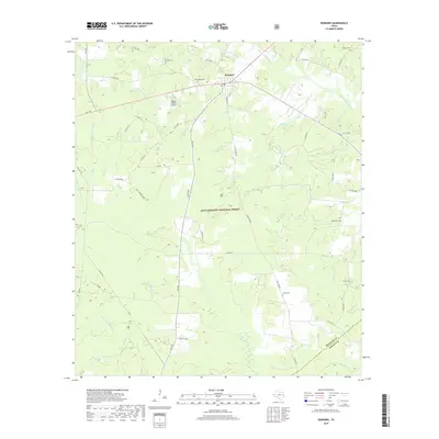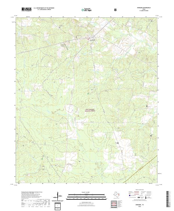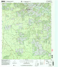
2004 Map of Kennard
USGS Topo · Published 2006About this map
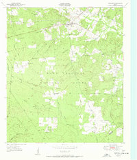
Kennard serves as the central hub of this East Texas survey, situated within the dense woodlands of the Davy Crockett National Forest. The landscape is defined by an intricate network of waterways, including Cochino Bayou, Elm Creek, and Piney Creek, which drain the timbered terrain. This 2004 revision reveals the persistence of rural community structures through numerous country churches and burial grounds such as Fairview Church, Corinth Cemetery, and Antioch Cemetery. The presence of established locations like the Horse Camp and Whiterock Hunt Camp reflects the area's ongoing identity as a recreational and timber resource. For local historians, the specific naming of prairies like Caddenhead Prairie and Race Track Prairie provides insight into traditional open-land landmarks that have survived the surrounding reforestation.
Find a feature on this map
41 named features on this map. Tap any name to fly to it.
Don’t see what you’re looking for? This feature index may not catch every label — zoom into the map to look around manually.
Map Details
Editions of this 2004 Kennard Map
This is the sole edition of this map. No revisions or reprints were ever made.
Historical Maps of Kennard Through Time
7 maps found