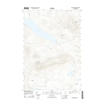
2014 Map of Kennebago Lake
USGS Topo · Published 2014About this map
Kennebago Lake dominates this portion of Franklin County, serving as the central basin for a complex system of feeder streams like Black Brook and Wilber Brook. The terrain is defined by high peaks including East Kennebago Mtn and Blackcat Mtn, which frame the deep Big Sag Basin to the north. A network of primitive and secondary roads, such as Grants Camps Rd and Mason Camps Rd, suggests a landscape shaped by seasonal camps and timber management rather than dense permanent settlement.
Find a feature on this map
43 named features on this map. Tap any name to fly to it.
Don’t see what you’re looking for? This feature index may not catch every label — zoom into the map to look around manually.
Map Details
Editions of this 2014 Kennebago Lake Map
This is the sole edition of this map. No revisions or reprints were ever made.
Other maps of this area

1931 · Cupsuptic
USGS Topo · 1:48,000

1932 · Kennebago Lake
USGS Topo · 1:48,000

1933 · Rangeley
USGS Topo · 1:48,000

1934 · Cupsuptic
USGS Topo · 1:62,500

1935 · Kennebago Lake
USGS Topo · 1:62,500

1935 · Cupsuptic
USGS Topo · 1:62,500

1936 · Kennebago Lake
USGS Topo · 1:62,500

1939 · Rangeley
USGS Topo · 1:62,500

1940 · Oquossoc
USGS Topo · 1:62,500

1942 · Oquossoc
USGS Topo · 1:62,500