
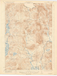
1935 Map of Cupsuptic
USGS Topo · Published 1935About this map
The remote northwestern Maine woods of Oxford and Franklin counties are defined here by a network of logging and sporting camps. Along the Cupsuptic River, clusters of outposts like Cupsuptic Sporting Camp and Riverside Camp serve as the primary human presence amidst the deep forests. The landscape reflects the early 20th-century reliance on seasonal camps and water-based transportation, with the Parmachenee Club on Parmachenee Lake standing as a significant local institution near the Canada United States border.
Find a feature on this map
97 named features on this map. Tap any name to fly to it.
Don’t see what you’re looking for? This feature index may not catch every label — zoom into the map to look around manually.
Map Details
Editions of this 1935 Cupsuptic Map
3 editions found
Other maps of this area

1927 · Moose Bog
USGS Topo · 1:48,000

1927 · Second Lake
USGS Topo · 1:62,500

1928 · Chain Lakes
USGS Topo · 1:48,000

1930 · Errol
USGS Topo · 1:62,500

1931 · Cupsuptic
USGS Topo · 1:48,000

1931 · Moose Bog
USGS Topo · 1:62,500

1932 · Kennebago Lake
USGS Topo · 1:48,000

1932 · Second Lake
USGS Topo · 1:62,500

1932 · Arnold Pond
USGS Topo · 1:48,000

1932 · Chain Lakes
USGS Topo · 1:62,500