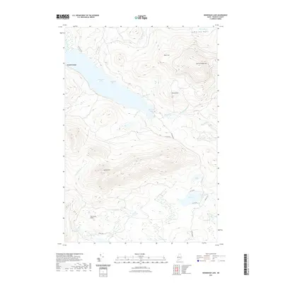
2021 Map of Kennebago Lake
USGS Topo · Published 2021About this map
Grants Camps sits on the northern shore of Kennebago Lake, serving as a focal point for this remote wilderness in Franklin County. The landscape is defined by the high elevations of East Kennebago Mtn and Blackcat Mtn, with a complex network of glacial ponds and wetlands distributed throughout the drainage basins. Notable water bodies include the secluded Loon Lake, Cow Pond, and the family-named Ben Gile Pond.
Find a feature on this map
38 named features on this map. Tap any name to fly to it.
Don’t see what you’re looking for? This feature index may not catch every label — zoom into the map to look around manually.
Map Details
Editions of this 2021 Kennebago Lake Map
This is the sole edition of this map. No revisions or reprints were ever made.
Other maps of this area

1931 · Cupsuptic
USGS Topo · 1:48,000

1932 · Kennebago Lake
USGS Topo · 1:48,000

1933 · Rangeley
USGS Topo · 1:48,000

1934 · Cupsuptic
USGS Topo · 1:62,500

1935 · Kennebago Lake
USGS Topo · 1:62,500

1935 · Cupsuptic
USGS Topo · 1:62,500

1936 · Kennebago Lake
USGS Topo · 1:62,500

1939 · Rangeley
USGS Topo · 1:62,500

1940 · Oquossoc
USGS Topo · 1:62,500

1942 · Oquossoc
USGS Topo · 1:62,500