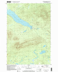
1997 Map of Kennebago Lake
USGS Topo · Published 2000About this map
Kennebago Lake and the surrounding township boundaries of the Western Maine mountains define this late-twentieth-century landscape. The area is characterized by seasonal sporting camps and timber infrastructure, most notably Grants Camps on the western shore and Kennebago Lake Camps at Blanchard Cove. The terrain is marked by significant elevations like Spotted Mountain and East Kennebago Mtn, while the lowlands are an intricate network of bogs and specialized water features like Forks Bogan, Long Logan, and Gile Logan.
Find a feature on this map
38 named features on this map. Tap any name to fly to it.
Don’t see what you’re looking for? This feature index may not catch every label — zoom into the map to look around manually.
Map Details
Editions of this 1997 Kennebago Lake Map
This is the sole edition of this map. No revisions or reprints were ever made.
Other maps of this area

1931 · Cupsuptic
USGS Topo · 1:48,000

1932 · Kennebago Lake
USGS Topo · 1:48,000

1933 · Rangeley
USGS Topo · 1:48,000

1934 · Cupsuptic
USGS Topo · 1:62,500

1935 · Kennebago Lake
USGS Topo · 1:62,500

1935 · Cupsuptic
USGS Topo · 1:62,500

1936 · Kennebago Lake
USGS Topo · 1:62,500

1939 · Rangeley
USGS Topo · 1:62,500

1940 · Oquossoc
USGS Topo · 1:62,500

1942 · Oquossoc
USGS Topo · 1:62,500
Featured Places
- Rangeley, ME
- Dallas Plantation, ME
- Tim Pond Township, ME
- Stetsontown Township, ME
- Grants Camps, Stetsontown Township