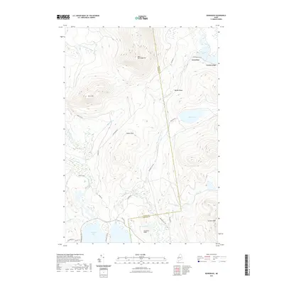
2021 Map of Kennebago
USGS Topo · Published 2021About this map
The Kennebago River valley and its surrounding high ridges define this remote portion of western Maine, where the border between Oxford and Franklin Counties cuts through the timberlands. The settlement of Kennebago and the historic Grants Camps sit at the southern tip of Kennebago Lake, serving as long-standing landmarks for the region's sporting and logging traditions. The landscape is marked by significant peaks such as West Kennebago Mtn and Burnt Mtn, while the southern reaches extend toward the shores of Cupsuptic Lake.
Find a feature on this map
34 named features on this map. Tap any name to fly to it.
Don’t see what you’re looking for? This feature index may not catch every label — zoom into the map to look around manually.
Map Details
Editions of this 2021 Kennebago Map
This is the sole edition of this map. No revisions or reprints were ever made.
Other maps of this area

1931 · Cupsuptic
USGS Topo · 1:48,000

1932 · Kennebago Lake
USGS Topo · 1:48,000

1933 · Rangeley
USGS Topo · 1:48,000

1934 · Cupsuptic
USGS Topo · 1:62,500

1935 · Kennebago Lake
USGS Topo · 1:62,500

1935 · Cupsuptic
USGS Topo · 1:62,500

1936 · Kennebago Lake
USGS Topo · 1:62,500

1939 · Rangeley
USGS Topo · 1:62,500

1940 · Oquossoc
USGS Topo · 1:62,500

1942 · Oquossoc
USGS Topo · 1:62,500
Featured Places
- Rangeley, ME
- Adamstown Township, ME
- Davis Town, Davis Township
- Stetsontown Township, ME
- Davis Township, ME