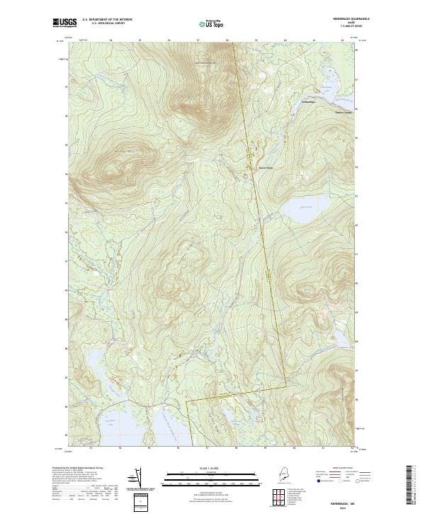
2024 Map of Kennebago
USGS Topo · Published 2024About this map
Kennebago Lake and the winding Kennebago River anchor this survey of the Maine North Woods, where the border between Oxford Co and Franklin Co runs through a landscape of timber-industry legacy and outdoor sporting camps. The settlement of Kennebago and the nearby Grants Camps reflect the long-standing recreational tradition in this corner of the state. These camps are connected by a network of private and service roads like Grants Camp Rd and Kennebago River Rd.
Find a feature on this map
36 named features on this map. Tap any name to fly to it.
Don’t see what you’re looking for? This feature index may not catch every label — zoom into the map to look around manually.
Map Details
Editions of this 2024 Kennebago Map
This is the sole edition of this map. No revisions or reprints were ever made.
Other maps of this area

1931 · Cupsuptic
USGS Topo · 1:48,000

1932 · Kennebago Lake
USGS Topo · 1:48,000

1933 · Rangeley
USGS Topo · 1:48,000

1934 · Cupsuptic
USGS Topo · 1:62,500

1935 · Kennebago Lake
USGS Topo · 1:62,500

1935 · Cupsuptic
USGS Topo · 1:62,500

1936 · Kennebago Lake
USGS Topo · 1:62,500

1939 · Rangeley
USGS Topo · 1:62,500

1940 · Oquossoc
USGS Topo · 1:62,500

1942 · Oquossoc
USGS Topo · 1:62,500
Featured Places
- Rangeley, ME
- Lower Cupsuptic Township, ME
- Upper Cupsuptic Township, ME
- Adamstown Township, ME
- Stetsontown Township, ME