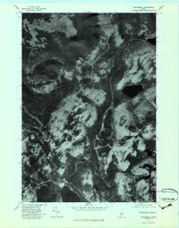
1977 Map of Kennebago
USGS Topo · Published 1983About this map
Cupsuptic Lake and its surrounding timberlands are captured in this orthophotomap, which utilizes aerial imagery from the late 1970s. The landscape is defined by the winding course of the Kennebago River and the Kamankeag River, which drain through the heavily forested terrain of Oxford County. The photography reveals the intricate network of logging roads and clearings that characterize the industrial forest management of the era, contrasting with the natural elevations of West Kennebago Mountain. The confluence of the Cupsuptic River and the main lake provided a focal point for water-based transport and drainage in this western Maine wilderness, while smaller water bodies like Johns Pond dot the higher ground. This specialized survey provides a precise visual record of the shoreline and vegetation patterns before later regrowth and development altered these forest corridors.
Find a feature on this map
6 named features on this map. Tap any name to fly to it.
Don’t see what you’re looking for? This feature index may not catch every label — zoom into the map to look around manually.
Map Details
Editions of this 1977 Kennebago Map
This is the sole edition of this map. No revisions or reprints were ever made.
Other maps of this area

1931 · Cupsuptic
USGS Topo · 1:48,000

1932 · Kennebago Lake
USGS Topo · 1:48,000

1933 · Rangeley
USGS Topo · 1:48,000

1934 · Cupsuptic
USGS Topo · 1:62,500

1935 · Kennebago Lake
USGS Topo · 1:62,500

1935 · Cupsuptic
USGS Topo · 1:62,500

1936 · Kennebago Lake
USGS Topo · 1:62,500

1939 · Rangeley
USGS Topo · 1:62,500

1940 · Oquossoc
USGS Topo · 1:62,500

1942 · Oquossoc
USGS Topo · 1:62,500
Featured Places
- Rangeley, ME
- Adamstown Township, ME
- Stetsontown Township, ME
- Lower Cupsuptic Township, ME
- Kennebago, Stetsontown Township