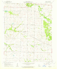
1962 Map of Kenoma
USGS Topo · Published 1963About this map
The St Louis - San Francisco railroad cuts a diagonal path through this rural Missouri landscape, connecting the small settlement of Kenoma to the broader regional economy. Surveyed in the late 1950s and updated in the early 1960s, the map reveals a meticulously organized township system including Lamar, Newport, Richland, and Golden City. This era shows a high density of one-room schoolhouses serving the agricultural community, such as Montrose Sch, Star Valley Sch, and Dorris Valley Sch, many of which were the social anchors of their respective districts.
Find a feature on this map
22 named features on this map. Tap any name to fly to it.
Don’t see what you’re looking for? This feature index may not catch every label — zoom into the map to look around manually.
Map Details
Editions of this 1962 Kenoma Map
2 editions found
Other maps of this area

1886 · Nevada
USGS Topo · 1:125,000

1886 · Carthage
USGS Topo · 1:125,000

1894 · Nevada
USGS Topo · 1:125,000

1894 · Carthage
USGS Topo · 1:125,000

1947 · Joplin
USGS Topo · 1:250,000

1949 · Joplin
USGS Topo · 1:250,000

1954 · Joplin
USGS Topo · 1:250,000

1958 · Joplin
USGS Topo · 1:250,000

1959 · Joplin
USGS Topo · 1:250,000
1962 · Jerico Springs
USGS Topo · 1:24,000