Loading...
Loading map...2022 Map of Kenosha
USGS Topo · Published 2022About this map
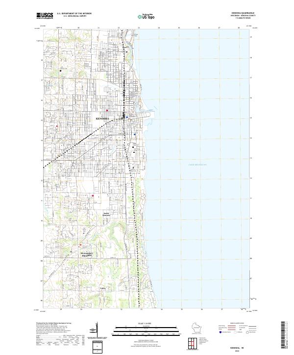
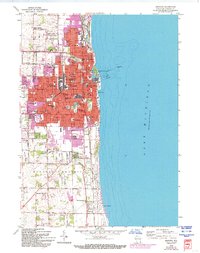
The industrialized shoreline of Lake Michigan anchors this map, where the city of Kenosha extends its grid across the landscape of southeast Wisconsin. The map captures a high density of civic and religious institutions, from the Kenosha County Courthouse downtown to several faith-based burial grounds including Saint George Cem and Saint Casimir Cem. These sites, along with education hubs like Carthage College, reflect the deep-rooted community infrastructure of the region.
Find a feature on this map
30 named features on this map. Tap any name to fly to it.
Don’t see what you’re looking for? This feature index may not catch every label — zoom into the map to look around manually.
Map Details
Date Portrayed2022
Date Published2022
PublisherU.S. Geological Survey
Map TypeTopographic
Scale1:24,000
Physical Dimensions24 x 29 inches
Editions of this 2022 Kenosha Map
This is the sole edition of this map. No revisions or reprints were ever made.
Historical Maps of Kenosha Through Time
Featured Locations
Source Details
SourceU.S. Geological Survey
CopyrightPublic Domain