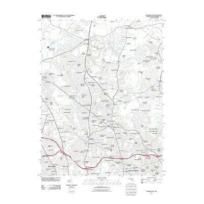
2011 Map of Kensington
USGS Topo · Published 2011About this map
Silver Spring and the surrounding Montgomery County suburbs appear as a dense network of residential subdivisions and vital waterways in this 2011 survey. The landscape is defined by the Northwest Branch Anacostia River and Rock Creek, which provide green corridors through established neighborhoods like Kemp Mill Forest, Colesville, and Norbeck. The presence of numerous historic burial sites, including Gate of Heaven Cemetery and the Grace Episcopal Cemetery, provides essential data for genealogists tracing local family roots.
Find a feature on this map
290 named features on this map. Tap any name to fly to it.
Don’t see what you’re looking for? This feature index may not catch every label — zoom into the map to look around manually.
Map Details
Editions of this 2011 Kensington Map
This is the sole edition of this map. No revisions or reprints were ever made.
Other maps of this area

1890 · Mt. Vernon
USGS Topo · 1:125,000

1891 · Mt. Vernon
USGS Topo · 1:125,000

1892 · Laurel
USGS Topo · 1:62,500

1893 · Frederick
USGS Topo · 1:125,000

1894 · Laurel
USGS Topo · 1:62,500

1894 · Frederick
USGS Topo · 1:125,000

1894 · Mt. Vernon
USGS Topo · 1:125,000

1897 · Laurel
USGS Topo · 1:62,500

1897 · Mt. Vernon
USGS Topo · 1:125,000

1899 · Patuxent
USGS Topo · 1:125,000