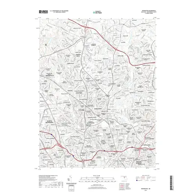
2019 Map of Kensington
USGS Topo · Published 2019About this map
Rock Creek and the Northwest Branch Anacostia River define the suburban layout of Montgomery County in this detailed 2019 survey. The area is characterized by a dense network of residential developments and established communities such as Norbeck, Rossmoor, and the senior-living enclave of Leisure World. This modern record reveals the preservation of significant local heritage through its cemeteries, including the Bonifant Family Cemetery and the Beall Cemetery, which remain surrounded by later growth. The topography is shaped by the Rock Creek Valley and the recreational waters of Lake Bernard Frank, illustrating how mid-to-late 20th-century urban expansion integrated with the region's natural drainage systems. Notable local landmarks like the Parklawn Memorial Park and Menorah Gardens and the Burnt Mills Village area highlight the transition from early rural holdings to the current integrated landscape of Maryland's capital suburbs.
Find a feature on this map
176 named features on this map. Tap any name to fly to it.
Don’t see what you’re looking for? This feature index may not catch every label — zoom into the map to look around manually.
Map Details
Editions of this 2019 Kensington Map
This is the sole edition of this map. No revisions or reprints were ever made.
Other maps of this area

1890 · Mt. Vernon
USGS Topo · 1:125,000

1891 · Mt. Vernon
USGS Topo · 1:125,000

1892 · Laurel
USGS Topo · 1:62,500

1893 · Frederick
USGS Topo · 1:125,000

1894 · Laurel
USGS Topo · 1:62,500

1894 · Frederick
USGS Topo · 1:125,000

1894 · Mt. Vernon
USGS Topo · 1:125,000

1897 · Laurel
USGS Topo · 1:62,500

1897 · Mt. Vernon
USGS Topo · 1:125,000

1899 · Patuxent
USGS Topo · 1:125,000