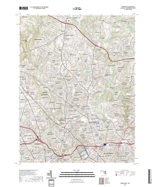
2023 Map of Kensington
USGS Topo · Published 2023About this map
The suburban developments of Montgomery County characterize this landscape, showing a dense network of neighborhoods such as Leisure World, Aspen Hill, and Colesville. The map is particularly rich in genealogical data, preserving the locations of numerous small and large burial grounds including the Bonifant Family Cem, Higgins Family Cem, and the Bethesda Meeting House Cem. These sites, along with the Judean Memorial Gardens and Gate of Heaven Cem, provide a fixed record of the community’s heritage amidst modern expansion.
Find a feature on this map
566 named features on this map. Tap any name to fly to it.
Don’t see what you’re looking for? This feature index may not catch every label — zoom into the map to look around manually.
Map Details
Editions of this 2023 Kensington Map
This is the sole edition of this map. No revisions or reprints were ever made.
Other maps of this area

1890 · Mt. Vernon
USGS Topo · 1:125,000

1891 · Mt. Vernon
USGS Topo · 1:125,000

1892 · Laurel
USGS Topo · 1:62,500

1893 · Frederick
USGS Topo · 1:125,000

1894 · Laurel
USGS Topo · 1:62,500

1894 · Frederick
USGS Topo · 1:125,000

1894 · Mt. Vernon
USGS Topo · 1:125,000

1897 · Laurel
USGS Topo · 1:62,500

1897 · Mt. Vernon
USGS Topo · 1:125,000

1899 · Patuxent
USGS Topo · 1:125,000