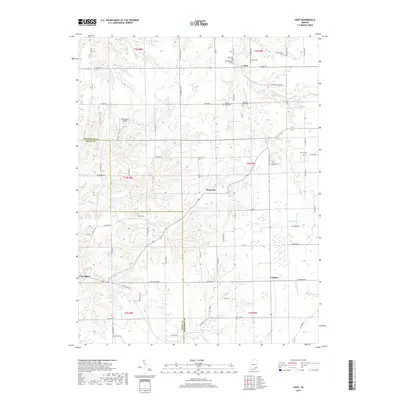
2019 Map of Kent
USGS Topo · Published 2019About this map
The border of Jefferson and Scott Counties defines the western edge of this landscape, where the settlements of Kent, Swanville, and Chelsea are connected by a network of rural roads. Numerous burial grounds are documented here, including Kent Cem, Blankenship Cem, and Slippery Point Cem, providing valuable data for genealogical research. The terrain is deeply carved by watercourses, with Big Spring Cr and Ramsey Creek flowing toward the east, while the W Fork Fourteenmile Cr drains the southern reaches. Near the county line, the presence of Wilkerson's Airport and the dammed waters of Arthur S Kingman Lake indicate twentieth-century land use shifts alongside traditional agricultural holdings and the established town of Lexington.
Find a feature on this map
87 named features on this map. Tap any name to fly to it.
Don’t see what you’re looking for? This feature index may not catch every label — zoom into the map to look around manually.
Map Details
Editions of this 2019 Kent Map
This is the sole edition of this map. No revisions or reprints were ever made.
Other maps of this area

1939 · Bethlehem
USGS Topo · 1:24,000

1939 · Madison West
USGS Topo · 1:24,000

1948 · Bethlehem
USGS Topo · 1:24,000

1948 · Madison West
USGS Topo · 1:24,000

1953 · Madison West
USGS Topo · 1:24,000

1953 · Bethlehem
USGS Topo · 1:24,000

1956 · Otisco
USGS Topo · 1:24,000

1956 · Volga
USGS Topo · 1:24,000

1956 · Blocher
USGS Topo · 1:24,000

1956 · Kent
USGS Topo · 1:24,000