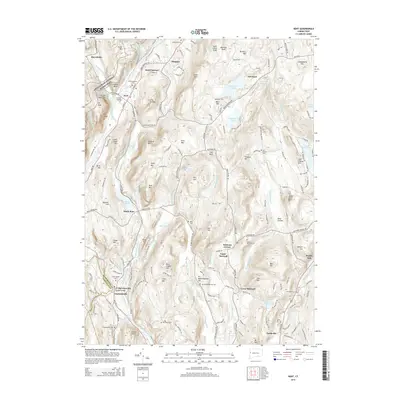
2015 Map of Kent
USGS Topo · Published 2015About this map
The Housatonic River carves a deep path through this Litchfield County landscape, anchoring a corridor of historic settlements from Kent and Flanders down to Gaylordsville. The terrain is defined by prominent peaks like Saint Johns Peak and Bull Mtn, with the Appalachian National Scenic Trail traversing the western ridges through Macedonia Brook State Park. This mid-2010s survey captures the area's rural character, where small clusters such as Merwinsville and Erickson Corner sit nestled between high elevations like Ore Hill and The Cobble. The eastern portion of the map is dominated by the waters of Lake Waramaug and S Spectacle Pond, while several upland cemeteries, including Upper Merryall Cem and West Meetinghouse Cem, provide essential data points for local genealogy and land-use history.
Find a feature on this map
182 named features on this map. Tap any name to fly to it.
Don’t see what you’re looking for? This feature index may not catch every label — zoom into the map to look around manually.
Map Details
Editions of this 2015 Kent Map
This is the sole edition of this map. No revisions or reprints were ever made.
Other maps of this area

1892 · Cornwall
USGS Topo · 1:62,500

1892 · New Milford
USGS Topo · 1:62,500

1893 · New Milford
USGS Topo · 1:62,500

1893 · Cornwall
USGS Topo · 1:62,500

1893 · Clove
USGS Topo · 1:62,500

1894 · Clove
USGS Topo · 1:62,500

1898 · Clove
USGS Topo · 1:62,500

1899 · Millbrook
USGS Topo · 1:62,500

1901 · Clove
USGS Topo · 1:62,500

1902 · Millbrook
USGS Topo · 1:62,500