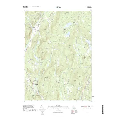
2018 Map of Kent
USGS Topo · Published 2018About this map
The Housatonic River carves through this Litchfield County landscape, anchoring a corridor of historical settlements from Kent and Kent Furnace south to Gaylordsville and Merwinsville. This 2018 survey reveals a terrain defined by high summits like Bromica Mtn and Fuller Mtn, alongside significant water bodies including North Spectacle Pond and a portion of Lake Waramaug. Genealogists will find numerous burial sites across the township, such as Gaylordsville Cem and the Upper Merryall Cem, while hikers can trace the winding path of the Appalachian National Scenic Trail as it crosses the river near Fuller Bridge. The map also captures several distinctive local landmarks, from the geological interest of Glacier Rock and Grand Staircase to the industrial history implied by Ore Hill, reflecting the region’s long-standing connection to both its natural resources and its preserved backcountry.
Find a feature on this map
178 named features on this map. Tap any name to fly to it.
Don’t see what you’re looking for? This feature index may not catch every label — zoom into the map to look around manually.
Map Details
Editions of this 2018 Kent Map
This is the sole edition of this map. No revisions or reprints were ever made.
Other maps of this area

1892 · Cornwall
USGS Topo · 1:62,500

1892 · New Milford
USGS Topo · 1:62,500

1893 · New Milford
USGS Topo · 1:62,500

1893 · Cornwall
USGS Topo · 1:62,500

1893 · Clove
USGS Topo · 1:62,500

1894 · Clove
USGS Topo · 1:62,500

1898 · Clove
USGS Topo · 1:62,500

1899 · Millbrook
USGS Topo · 1:62,500

1901 · Clove
USGS Topo · 1:62,500

1902 · Millbrook
USGS Topo · 1:62,500