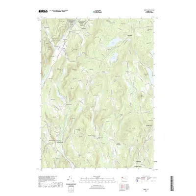
2021 Map of Kent
USGS Topo · Published 2021About this map
The Housatonic River carves a deep valley through this western Connecticut landscape, passing the primary settlement at Kent and the historic industrial site of Kent Furnace. The Appalachian National Scenic Trail winds across the high ground to the west, traversing peaks like Fuller Mtn and Mt Algo before crossing the river near Fuller Bridge. The terrain is defined by numerous high ridges and glacial features, including The Cobble and Glacier Rock.
Find a feature on this map
168 named features on this map. Tap any name to fly to it.
Don’t see what you’re looking for? This feature index may not catch every label — zoom into the map to look around manually.
Map Details
Editions of this 2021 Kent Map
This is the sole edition of this map. No revisions or reprints were ever made.
Other maps of this area

1892 · Cornwall
USGS Topo · 1:62,500

1892 · New Milford
USGS Topo · 1:62,500

1893 · New Milford
USGS Topo · 1:62,500

1893 · Cornwall
USGS Topo · 1:62,500

1893 · Clove
USGS Topo · 1:62,500

1894 · Clove
USGS Topo · 1:62,500

1898 · Clove
USGS Topo · 1:62,500

1899 · Millbrook
USGS Topo · 1:62,500

1901 · Clove
USGS Topo · 1:62,500

1902 · Millbrook
USGS Topo · 1:62,500