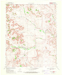
1969 Map of Kenton NE
USGS Topo · Published 1971About this map
The Cimarron River winds through this panhandle landscape, defining a complex system of drainage and canyon topography at the border of Oklahoma and Colorado. This 1969 survey, produced in cooperation with the Oklahoma Water Resources Board, illustrates a land shaped by deep incisions like Gallinas Canon and Pat Canyon. The terrain is punctuated by distinctive geological landmarks such as Castle Rock, which stands near the river's path, and numerous named washes including Carrizo Creek and Willow Creek.
Find a feature on this map
19 named features on this map. Tap any name to fly to it.
Don’t see what you’re looking for? This feature index may not catch every label — zoom into the map to look around manually.
Map Details
Editions of this 1969 Kenton NE Map
This is the sole edition of this map. No revisions or reprints were ever made.
Other maps of this area

1891 · Springfield
USGS Topo · 1:125,000

1893 · Springfield
USGS Topo · 1:125,000

1954 · Dalhart
USGS Topo · 1:250,000

1955 · La Junta
USGS Topo · 1:250,000

1958 · La Junta
USGS Topo · 1:250,000

1958 · Dalhart
USGS Topo · 1:250,000

1962 · Dalhart
USGS Topo · 1:250,000

1968 · La Junta
USGS Topo · 1:250,000

1968 · Autograph Cliff NW
USGS Topo · 1:24,000

1968 · Kenton
USGS Topo · 1:24,000