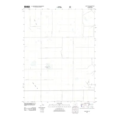
2011 Map of Keota NW
USGS Topo · Published 2011About this map
Seven Cross Hill rises above the open high plains of northern Colorado in this 2011 survey of Weld County. The landscape is defined by a rigorous section-line road grid, including County Rd 100 and County Rd 89, which facilitates access across this rural expanse. Ephemeral watercourses like Crow Creek and Jackson Draw carve subtle drainage patterns through the terrain, indicating the arid nature of the region. A notable point of human activity is the private William Leon Schawo Airport, situated centrally among the agricultural and grazing lands. This map captures the intersection of traditional western land management and modern aviation, where small airstrips serve remote ranching communities and local infrastructure follows the geometric precision of the Public Land Survey System.
Find a feature on this map
18 named features on this map. Tap any name to fly to it.
Don’t see what you’re looking for? This feature index may not catch every label — zoom into the map to look around manually.
Map Details
Editions of this 2011 Keota NW Map
This is the sole edition of this map. No revisions or reprints were ever made.
Other maps of this area

1954 · Greeley
USGS Topo · 1:250,000

1957 · Greeley
USGS Topo · 1:250,000

1958 · Greeley
USGS Topo · 1:250,000

1961 · Greeley
USGS Topo · 1:250,000

1964 · Greeley
USGS Topo · 1:250,000

1965 · Greeley
USGS Topo · 1:250,000

1972 · Dutch Girl Lake
USGS Topo · 1:24,000
1972 · Keota SE
USGS Topo · 1:24,000

1972 · Briggsdale
USGS Topo · 1:24,000

1972 · Keota NW
USGS Topo · 1:24,000