
1972 Map of Dutch Girl Lake
USGS Topo · Published 1974About this map
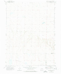
Greasewood Flats defines the lower third of this 1972 topographical survey, where the dry terrain of northeastern Colorado meets the expanding energy footprint of the early seventies. The landscape is marked by a network of resource extraction, with numerous Gas Wells, Oil Wells, and generic Well sites scattered across the township grid. This map captures the rural isolation along the county line between Weld Co and Morgan Co, a region where water sources like Dutch Girl Lake were essential landmarks for ranchers and drillers alike. A small, solitary burial site, Pilgrim Cem, sits near the center of the quadrangle, offering a point of interest for genealogists tracing early families in this corner of the High Plains before modern industrial development fully transformed the open range.
Find a feature on this map
8 named features on this map. Tap any name to fly to it.
Don’t see what you’re looking for? This feature index may not catch every label — zoom into the map to look around manually.
Map Details
Editions of this 1972 Dutch Girl Lake Map
2 editions found
Other maps of this area

1950 · Greasewood Lake
USGS Topo · 1:24,000

1951 · Sunken Lake
USGS Topo · 1:24,000

1951 · Point Of Rocks
USGS Topo · 1:24,000

1954 · Greeley
USGS Topo · 1:250,000

1957 · Greeley
USGS Topo · 1:250,000

1958 · Greeley
USGS Topo · 1:250,000

1961 · Greeley
USGS Topo · 1:250,000

1964 · Greeley
USGS Topo · 1:250,000

1965 · Greeley
USGS Topo · 1:250,000
1972 · Keota SE
USGS Topo · 1:24,000