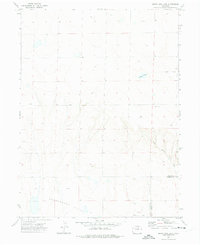
1972 Map of Dutch Girl Lake
USGS Topo · Published 1975About this map
Greasewood Flats and the surrounding high plains of northeastern Colorado appear here during a period of active energy exploration in the early 1970s. The landscape is defined by its topographic subtly, where ephemeral drainages like Coal Bank Draw cut through the arid terrain. Human presence is sparse but distinct, marked by a scattering of industrial sites such as the Gas Well and various Oil Wells, indicating the region's economic reliance on subsurface resources.
Find a feature on this map
8 named features on this map. Tap any name to fly to it.
Don’t see what you’re looking for? This feature index may not catch every label — zoom into the map to look around manually.
Map Details
Editions of this 1972 Dutch Girl Lake Map
2 editions found
Other maps of this area

1950 · Greasewood Lake
USGS Topo · 1:24,000

1951 · Sunken Lake
USGS Topo · 1:24,000

1951 · Point Of Rocks
USGS Topo · 1:24,000

1954 · Greeley
USGS Topo · 1:250,000

1957 · Greeley
USGS Topo · 1:250,000

1958 · Greeley
USGS Topo · 1:250,000

1961 · Greeley
USGS Topo · 1:250,000

1964 · Greeley
USGS Topo · 1:250,000

1965 · Greeley
USGS Topo · 1:250,000

1972 · Dutch Girl Lake
USGS Topo · 1:24,000