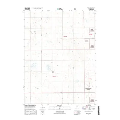
2016 Map of Keota NW
USGS Topo · Published 2016About this map
Pawnee National Grassland dominates the eastern and southern margins of this Weld County landscape, where the high plains terrain is defined by wide drainages and intermittent water features. The topographic data reveals a complex system of shallow depressions and draws, most notably Jackson Draw and the course of Crow Cr in the northwest. This area serves as a transition between open rangeland and the managed conservation areas of the national grassland system.
Find a feature on this map
22 named features on this map. Tap any name to fly to it.
Don’t see what you’re looking for? This feature index may not catch every label — zoom into the map to look around manually.
Map Details
Editions of this 2016 Keota NW Map
This is the sole edition of this map. No revisions or reprints were ever made.
Other maps of this area

1954 · Greeley
USGS Topo · 1:250,000

1957 · Greeley
USGS Topo · 1:250,000

1958 · Greeley
USGS Topo · 1:250,000

1961 · Greeley
USGS Topo · 1:250,000

1964 · Greeley
USGS Topo · 1:250,000

1965 · Greeley
USGS Topo · 1:250,000

1972 · Dutch Girl Lake
USGS Topo · 1:24,000
1972 · Keota SE
USGS Topo · 1:24,000

1972 · Briggsdale
USGS Topo · 1:24,000

1972 · Keota NW
USGS Topo · 1:24,000