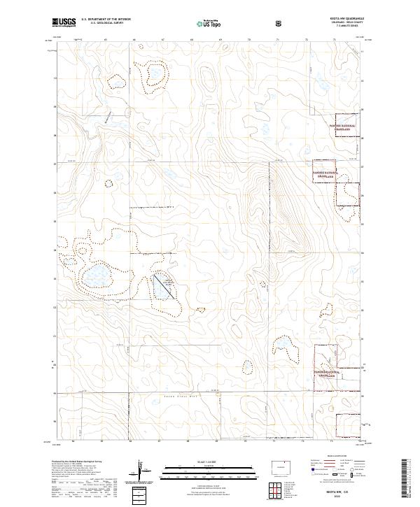
2022 Map of Keota NW
USGS Topo · Published 2022About this map
The high plains of Weld County reveal a landscape of vast range and sparse infrastructure in this modern survey. Dominating the eastern portions of the quadrangle is the Pawnee National Grassland, a testament to the preservation of the shortgrass prairie. The terrain is marked by subtle but distinct features like the Seven Cross Hill and drainage systems including Jackson Draw and Crow Cr, which define the local topography.
Find a feature on this map
22 named features on this map. Tap any name to fly to it.
Don’t see what you’re looking for? This feature index may not catch every label — zoom into the map to look around manually.
Map Details
Editions of this 2022 Keota NW Map
This is the sole edition of this map. No revisions or reprints were ever made.
Other maps of this area

1954 · Greeley
USGS Topo · 1:250,000

1957 · Greeley
USGS Topo · 1:250,000

1958 · Greeley
USGS Topo · 1:250,000

1961 · Greeley
USGS Topo · 1:250,000

1964 · Greeley
USGS Topo · 1:250,000

1965 · Greeley
USGS Topo · 1:250,000

1972 · Dutch Girl Lake
USGS Topo · 1:24,000
1972 · Keota SE
USGS Topo · 1:24,000

1972 · Briggsdale
USGS Topo · 1:24,000

1972 · Keota NW
USGS Topo · 1:24,000