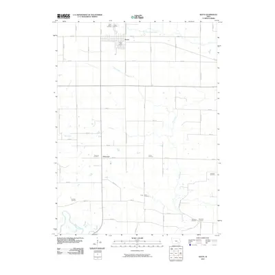
2010 Map of Keota
USGS Topo · Published 2010About this map
Keota serves as the primary hub of this eastern Iowa landscape, centered around the Keota Post Office and a grid of rural avenues. The surrounding countryside is defined by a dense network of family and community burial grounds, such as Saint Marys Cemetery and Keota Cemetery to the north, and Talleyrand Cemetery further south near the settlement of Talleyrand. These sites, along with others like Middleton Cemetery and Shockley Cemetery, indicate a well-established pattern of small rural clusters and church-centered communities.
Find a feature on this map
46 named features on this map. Tap any name to fly to it.
Don’t see what you’re looking for? This feature index may not catch every label — zoom into the map to look around manually.
Map Details
Editions of this 2010 Keota Map
This is the sole edition of this map. No revisions or reprints were ever made.
Other maps of this area

1954 · Des Moines
USGS Topo · 1:250,000

1956 · Des Moines
USGS Topo · 1:250,000

1957 · Des Moines
USGS Topo · 1:250,000

1958 · Davenport
USGS Topo · 1:250,000

1961 · Davenport
USGS Topo · 1:250,000

1962 · Davenport
USGS Topo · 1:250,000

1965 · Harper
USGS Topo · 1:24,000

1965 · South English
USGS Topo · 1:24,000

1969 · Des Moines
USGS Topo · 1:250,000
1973 · Wellman
USGS Topo · 1:24,000