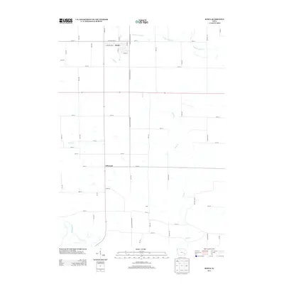
2013 Map of Keota
USGS Topo · Published 2013About this map
Keota serves as the primary hub of this eastern Keokuk County landscape, defined by a rigid section-line grid of rural roads and fertile Iowa farmland. The settlement of Talleyrand sits further south, positioned along the central corridor of Keokuk-Washington Rd. The geography is shaped by the drainage patterns of several winding waterways, including the Skunk River in the southwest corner and the meandering Dutch Cr which cuts diagonally across the township. Further north, the W Fork Crooked Cr and Clear Cr provide additional natural boundaries. This 2013 survey illustrates the enduring agricultural character of the region, where small named communities like Valley persist as local reference points amidst the sprawling network of gravel roads and tributary streams that have defined the county's layout for generations.
Find a feature on this map
47 named features on this map. Tap any name to fly to it.
Don’t see what you’re looking for? This feature index may not catch every label — zoom into the map to look around manually.
Map Details
Editions of this 2013 Keota Map
This is the sole edition of this map. No revisions or reprints were ever made.
Other maps of this area

1954 · Des Moines
USGS Topo · 1:250,000

1956 · Des Moines
USGS Topo · 1:250,000

1957 · Des Moines
USGS Topo · 1:250,000

1958 · Davenport
USGS Topo · 1:250,000

1961 · Davenport
USGS Topo · 1:250,000

1962 · Davenport
USGS Topo · 1:250,000

1965 · Harper
USGS Topo · 1:24,000

1965 · South English
USGS Topo · 1:24,000

1969 · Des Moines
USGS Topo · 1:250,000
1973 · Wellman
USGS Topo · 1:24,000