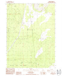
1988 Map of Kephart
USGS Topo · Published 1988About this map
Kephart sits at the center of this high-elevation landscape in the late 1980s, where the infrastructure of utility and resource management dominates the high plateau. The terrain is marked by a significant Pipeline corridor and an extensive network of 4wd tracks that cut through the Modoc National Forest. Water sources are sparse but critical in this volcanic region, noted by Quaking Aspen Spring and Little Quaking Aspen Spring in the southern portion of the map. To the north, the elevation rises toward Timber Mountain, while the southwestern quadrant is dedicated to the Long Bell State Game Refuge. This survey documents a quiet period of public land management, showing a landscape defined more by its natural boundaries and service roads than by permanent settlement, with a single Gravel Pit indicating local extractive activity.
Find a feature on this map
12 named features on this map. Tap any name to fly to it.
Don’t see what you’re looking for? This feature index may not catch every label — zoom into the map to look around manually.
Map Details
Editions of this 1988 Kephart Map
This is the sole edition of this map. No revisions or reprints were ever made.
Other maps of this area

1886 · Modoc Lava Bed
USGS Topo · 1:250,000

1892 · Modoc Lava-Bed
USGS Topo · 1:250,000

1952 · Timber Mountain
USGS Topo · 1:62,500

1952 · Hackamore
USGS Topo · 1:62,500

1954 · Alturas
USGS Topo · 1:250,000

1958 · Alturas
USGS Topo · 1:250,000

1962 · Alturas
USGS Topo · 1:250,000

1962 · Crank Mountain
USGS Topo · 1:62,500

1962 · White Horse
USGS Topo · 1:62,500

1965 · Alturas
USGS Topo · 1:250,000