
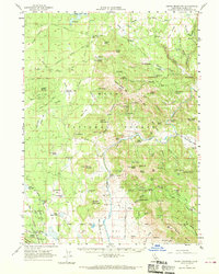
1962 Map of Crank Mountain
USGS Topo · Published 1963About this map
The Modoc National Forest landscape in the early 1960s was defined by a complex network of seasonal camps, administrative outposts, and timber access routes. Isolated homesteads and seasonal sites such as the Old Hulbert Place, Gerig Camp, and Allen Camp are scattered across the terrain, reflecting the region's legacy of ranching and forestry. The presence of the Happy Camp Guard Sta and the Radio Facilities Lookout atop Happy Camp Mtn underscores the area's importance for fire suppression and communications during this era.
Find a feature on this map
113 named features on this map. Tap any name to fly to it.
Don’t see what you’re looking for? This feature index may not catch every label — zoom into the map to look around manually.
Map Details
Editions of this 1962 Crank Mountain Map
2 editions found
Other maps of this area

1886 · Alturas
USGS Topo · 1:250,000

1886 · Modoc Lava Bed
USGS Topo · 1:250,000

1892 · Modoc Lava-Bed
USGS Topo · 1:250,000

1892 · Alturas
USGS Topo · 1:250,000

1952 · Timber Mountain
USGS Topo · 1:62,500

1952 · Hackamore
USGS Topo · 1:62,500

1954 · Alturas
USGS Topo · 1:250,000

1958 · Alturas
USGS Topo · 1:250,000

1961 · Canby
USGS Topo · 1:62,500

1961 · Bieber
USGS Topo · 1:62,500