
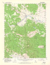
1961 Map of Canby
USGS Topo · Published 1963About this map
Modoc National Forest dominates this northern California landscape, where the Pit River cuts through Warm Springs Valley. In the early 1960s, the small community of Canby served as a central point for the Southern Pacific railroad line and a local airstrip. The map reveals a high-altitude terrain defined by significant peaks like Schaffer Mountain and Washington Mtn, alongside numerous canyons such as Blacks Canyon and Shake Canyon.
Find a feature on this map
85 named features on this map. Tap any name to fly to it.
Don’t see what you’re looking for? This feature index may not catch every label — zoom into the map to look around manually.
Map Details
Editions of this 1961 Canby Map
2 editions found
Other maps of this area

1886 · Alturas
USGS Topo · 1:250,000

1886 · Modoc Lava Bed
USGS Topo · 1:250,000

1892 · Modoc Lava-Bed
USGS Topo · 1:250,000

1892 · Alturas
USGS Topo · 1:250,000

1952 · Hackamore
USGS Topo · 1:62,500

1954 · Alturas
USGS Topo · 1:250,000

1958 · Alturas
USGS Topo · 1:250,000

1961 · Bieber
USGS Topo · 1:62,500

1961 · Alturas
USGS Topo · 1:62,500

1962 · Alturas
USGS Topo · 1:250,000