
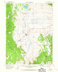
1961 Map of Bieber
USGS Topo · Published 1963About this map
Big Swamp and the surrounding river systems define this portion of the Pit River basin during the early 1960s. The settlement of Bieber serves as a central hub, flanked by Pumpkin Center and the specialized rail junction of Nubieber, where the Great Northern and Western Pacific railroads converge. This era of land management is evident in the numerous water control features like the Taylor Creek canal and various reservoirs such as Roberts Reservoir and Hardin Reservoir.
Find a feature on this map
67 named features on this map. Tap any name to fly to it.
Don’t see what you’re looking for? This feature index may not catch every label — zoom into the map to look around manually.
Map Details
Editions of this 1961 Bieber Map
2 editions found
Other maps of this area

1886 · Alturas
USGS Topo · 1:250,000

1886 · Honey Lake
USGS Topo · 1:250,000

1886 · Lassen Peak
USGS Topo · 1:250,000

1886 · Modoc Lava Bed
USGS Topo · 1:250,000

1891 · Honey Lake
USGS Topo · 1:250,000

1892 · Modoc Lava-Bed
USGS Topo · 1:250,000

1892 · Lassen Peak
USGS Topo · 1:250,000

1892 · Alturas
USGS Topo · 1:250,000

1893 · Honey Lake
USGS Topo · 1:250,000

1894 · Lassen Peak
USGS Topo · 1:250,000