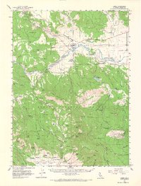
1961 Map of Canby
USGS Topo · Published 1968About this map
The Southern Pacific railroad corridor serves as the primary artery for northern California's timber and livestock economy in this 1961 study. Centered on the settlement of Canby, the landscape is a complex of volcanic terrain within the Modoc National Forest, characterized by numerous water resources like Rice Springs and Harris Spring. The map documents early aviation and emergency infrastructure, notably the Ambrose Station Heliport and an Airstrip near the river. Cultural history is anchored by the Evans and Bailey Historical Monument and the Lost Cabin Mine, suggesting a legacy of both frontier conflict and mineral exploration. The terrain is deeply carved by drainage systems like Howards Gulch and Blacks Canyon, while the presence of several Cinder Pit locations and a Quarry point to the region's active industrial extraction during the mid-century.
Find a feature on this map
113 named features on this map. Tap any name to fly to it.
Don’t see what you’re looking for? This feature index may not catch every label — zoom into the map to look around manually.
Map Details
Editions of this 1961 Canby Map
2 editions found
Other maps of this area

1886 · Alturas
USGS Topo · 1:250,000

1886 · Modoc Lava Bed
USGS Topo · 1:250,000

1892 · Modoc Lava-Bed
USGS Topo · 1:250,000

1892 · Alturas
USGS Topo · 1:250,000

1952 · Hackamore
USGS Topo · 1:62,500

1954 · Alturas
USGS Topo · 1:250,000

1958 · Alturas
USGS Topo · 1:250,000

1961 · Canby
USGS Topo · 1:62,500

1961 · Bieber
USGS Topo · 1:62,500

1961 · Alturas
USGS Topo · 1:62,500