1918 Map of Kerby
USGS Topo · Published 1918About this map
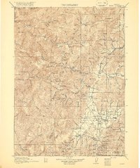
The Illinois River cuts through this corner of the Siskiyou National Forest in Josephine County, revealing an era of intense resource extraction. Mining operations define the southern landscape near the Oregon-California Boundary Line, where the Queen of Bronze Mine, Waldo Mine, and Cowboy Mine surround the settlements of Waldo and Takilma. These industrial sites were supported by a network of rural schools including Floyd School, Spence School, and White School, reflecting a settled population during the early twentieth century.
Find a feature on this map
165 named features on this map. Tap any name to fly to it.
Don’t see what you’re looking for? This feature index may not catch every label — zoom into the map to look around manually.
Map Details
Editions of this 1918 Kerby Map
2 editions found
Other maps of this area

1899 · Port Orford
USGS Topo · 1:125,000

1903 · Port Orford
USGS Topo · 1:125,000

1904 · Riddle
USGS Topo · 1:125,000

1908 · Grants Pass
USGS Topo · 1:125,000

1914 · Seiad
USGS Topo · 1:125,000

1917 · Kerby
USGS Topo · 1:125,000

1918 · Kerby
USGS Topo · 1:125,000

1922 · Preston Peak
USGS Topo · 1:125,000

1922 · Seiad
USGS Topo · 1:125,000

1929 · Crescent City
USGS Topo · 1:125,000