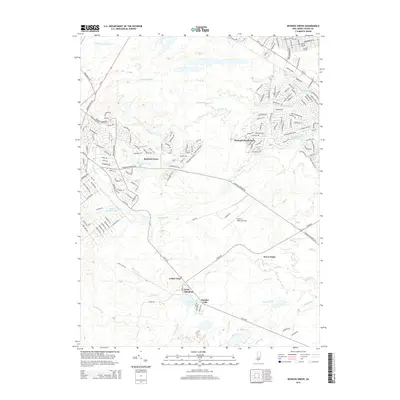
2014 Map of Keswick Grove
USGS Topo · Published 2014About this map
Keswick Grove and the surrounding Pine Barrens landscape are defined by a network of waterways and developing residential tracts in this 2014 study. The area is intersected by numerous branches and brooks, including Wrangel Brook, Michaels Br, and Davenport Br, which feed into local landmarks like Keswick Lake and Harry Wrights Lake. The map illustrates the transition from dense forest to organized residential communities, particularly around Wrangell Brook Park and the intersection of Pinewald Keswick Rd.
Find a feature on this map
157 named features on this map. Tap any name to fly to it.
Don’t see what you’re looking for? This feature index may not catch every label — zoom into the map to look around manually.
Map Details
Editions of this 2014 Keswick Grove Map
This is the sole edition of this map. No revisions or reprints were ever made.
Other maps of this area

1884 · Whitings
USGS Topo · 1:62,500

1888 · Barnegat
USGS Topo · 1:62,500

1888 · Asbury Park
USGS Topo · 1:62,500

1888 · Cassville
USGS Topo · 1:62,500

1888 · Whitings
USGS Topo · 1:62,500

1893 · Asbury Park
USGS Topo · 1:62,500

1893 · Barnegat
USGS Topo · 1:62,500

1894 · Cassville
USGS Topo · 1:62,500

1898 · Barnegat
USGS Topo · 1:62,500

1900 · Cassville
USGS Topo · 1:62,500
Featured Places
- Toms River, NJ
- Manchester Township, NJ
- Berkeley Township, NJ
- Lacey Township, NJ
- Crestwood Village, Manchester Township