2023 Map of Kettle Falls
USGS Topo · Published 2023About this map
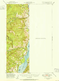
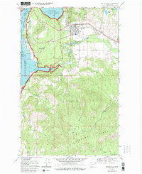
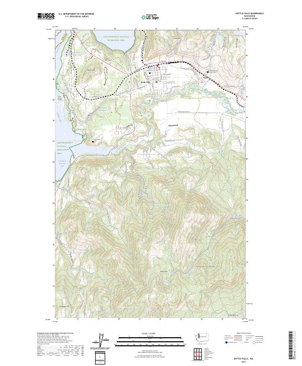
Kettle Falls and the surrounding Stevens County landscape are defined by the convergence of the Columbia River and Colville River, where modern industry and historical memory meet. This 2023 survey documents the industrial footprint of the Boise Cascade Mill Waste Pond alongside the recreation-heavy shoreline of the Lake Roosevelt National Recreation Area. The map provides significant detail for genealogists, featuring the Meyers Falls Cem, Grandview Cem, and the Saint Francis Regis Mission Cem near Ward. These burial grounds, along with the settlement at Greenwood, trace the area’s development away from the river banks and into the higher elevations of the Huckleberry Range and Mingo Mountain. The landscape transitions from the developed streets of the town center to the steep terrain of Gold Hill and Hawks Nest, while the Meyers Falls Reservoir and Blue Gulch Reservoir manage the local hydrology.
Find a feature on this map
82 named features on this map. Tap any name to fly to it.
Don’t see what you’re looking for? This feature index may not catch every label — zoom into the map to look around manually.
Map Details
Editions of this 2023 Kettle Falls Map
This is the sole edition of this map. No revisions or reprints were ever made.
Historical Maps of Kettle Falls Through Time
4 maps found