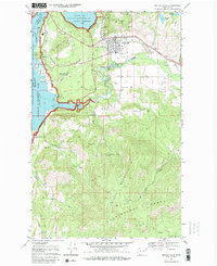
1969 Map of Kettle Falls
USGS Topo · Published 1980About this map
Kettle Falls serves as the focal point of this late 1960s landscape, situated where the Burlington Northern railroad meets the industrial and recreational corridor of the Columbia River. The map captures a moment when the regional economy was defined by resource extraction and hydroelectric development, evidenced by the Meyers Falls Res and various power facilities. The southern half is dominated by the steep slopes of the Huckleberry Mountain Range, revealing a legacy of prospecting through sites like the Broad Gauge Mine and Blue Grouse Mine. Along the eastern tracks, the small community of Ward and its Convent contrast with the rugged, undeveloped timberlands. The vast Franklin D Roosevelt Lake and the Coulee Dam National Recreation Area highlight the era's focus on managed water resources and public land use.
Find a feature on this map
44 named features on this map. Tap any name to fly to it.
Don’t see what you’re looking for? This feature index may not catch every label — zoom into the map to look around manually.
Map Details
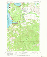
Editions of this 1969 Kettle Falls Map
2 editions found
Other maps of this area

1927 · Chewelah
USGS Topo · 1:125,000

1929 · Colville
USGS Topo · 1:125,000

1930 · Chewelah
USGS Topo · 1:125,000

1933 · Colville
USGS Topo · 1:125,000

1936 · Marcus
USGS Topo · 1:96,000

1942 · Marcus
USGS Topo · 1:125,000

1948 · Kettle Falls
USGS Topo · 1:62,500

1950 · Inchelium
USGS Topo · 1:62,500

1951 · Kettle Falls
USGS Topo · 1:62,500

1952 · Echo Valley
USGS Topo · 1:24,000