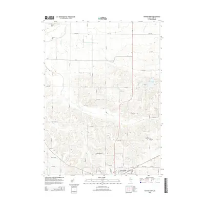
2015 Map of Kewanee North
USGS Topo · Published 2015About this map
The northern reaches of Kewanee anchor this Illinois landscape, where the northernmost residential streets meet a grid of rural section lines. The drainage patterns of the region are exceptionally defined, characterized by a complex network of natural waterways like Mud Cr and Walker Cr alongside man-made improvements such as the Broadbent Lateral Ditch and Acme Ditch. These systems reflect the intensive agricultural engineering common in Henry County, designed to manage the fertile prairie soil. To the northeast, Johnson Lake and Sauk Trail Pond provide distinct landmarks in an area dominated by farmland. Several sites of genealogical importance are distributed across the township, including Saint Michael Cem and the Garden of Peace Cem, while the more isolated Pace Cem sits further afield, marking the heritage of local families in this long-settled farming community.
Find a feature on this map
78 named features on this map. Tap any name to fly to it.
Don’t see what you’re looking for? This feature index may not catch every label — zoom into the map to look around manually.
Map Details
Editions of this 2015 Kewanee North Map
This is the sole edition of this map. No revisions or reprints were ever made.
Other maps of this area

1929 · Annawan
USGS Topo · 1:62,500

1931 · Galva
USGS Topo · 1:48,000

1932 · Annawan
USGS Topo · 1:62,500

1934 · Geneseo
USGS Topo · 1:62,500

1940 · Galva
USGS Topo · 1:62,500

1944 · Galva
USGS Topo · 1:62,500

1944 · Kewanee
USGS Topo · 1:62,500

1953 · German Corner
USGS Topo · 1:24,000
1953 · Galva
USGS Topo · 1:24,000
1953 · Atkinson
USGS Topo · 1:24,000