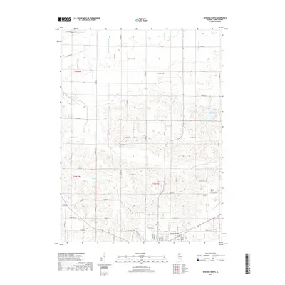
2018 Map of Kewanee North
USGS Topo · Published 2018About this map
The northern reaches of Kewanee anchor the southern edge of this 2018 survey, showing the city's transition into the rural agricultural landscape of Henry County. This area is defined by an intricate network of drainage infrastructure, where natural waterways like Mud Cr and the Edwards River are supplemented by man-made channels such as Acme Ditch and the Broadbent Lateral Ditch. These modifications reflect a long history of land management essential for maintaining the productivity of the surrounding prairie soil.
Find a feature on this map
82 named features on this map. Tap any name to fly to it.
Don’t see what you’re looking for? This feature index may not catch every label — zoom into the map to look around manually.
Map Details
Editions of this 2018 Kewanee North Map
This is the sole edition of this map. No revisions or reprints were ever made.
Other maps of this area

1929 · Annawan
USGS Topo · 1:62,500

1931 · Galva
USGS Topo · 1:48,000

1932 · Annawan
USGS Topo · 1:62,500

1934 · Geneseo
USGS Topo · 1:62,500

1940 · Galva
USGS Topo · 1:62,500

1944 · Galva
USGS Topo · 1:62,500

1944 · Kewanee
USGS Topo · 1:62,500

1953 · German Corner
USGS Topo · 1:24,000
1953 · Galva
USGS Topo · 1:24,000
1953 · Atkinson
USGS Topo · 1:24,000