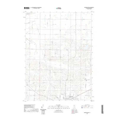
2021 Map of Kewanee North
USGS Topo · Published 2021About this map
The northern reaches of Kewanee anchor this Illinois landscape, where the transition from urban streets to a highly managed agricultural plain is clearly visible. Numerous drainage features like the Broadbent Lateral Ditch and Gradlett Ditch illustrate the extensive land engineering required to support the region's farming economy. Several cemeteries, including Saint Michael Cem and the Garden of Peace Cem, lie at the town's northern edge, providing important markers for local genealogists. Beyond the city limits, the terrain is defined by the winding paths of Mud Cr and Walker Cr, with the tiny settlement of Hickory Point situated in the northwest. The presence of Sauk Trail Pond reflects the historical path of the regional Sauk Trail, now integrated into the modern rural grid of county roads and highways.
Find a feature on this map
74 named features on this map. Tap any name to fly to it.
Don’t see what you’re looking for? This feature index may not catch every label — zoom into the map to look around manually.
Map Details
Editions of this 2021 Kewanee North Map
This is the sole edition of this map. No revisions or reprints were ever made.
Other maps of this area

1929 · Annawan
USGS Topo · 1:62,500

1931 · Galva
USGS Topo · 1:48,000

1932 · Annawan
USGS Topo · 1:62,500

1934 · Geneseo
USGS Topo · 1:62,500

1940 · Galva
USGS Topo · 1:62,500

1944 · Galva
USGS Topo · 1:62,500

1944 · Kewanee
USGS Topo · 1:62,500

1953 · German Corner
USGS Topo · 1:24,000
1953 · Galva
USGS Topo · 1:24,000
1953 · Atkinson
USGS Topo · 1:24,000