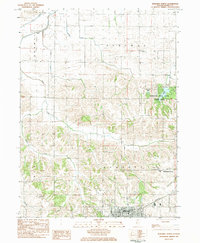
1983 Map of Kewanee North
USGS Topo · Published 1984About this map
The northern reaches of Kewanee and the surrounding townships of Annawan, Burns, and Cornwall define this Illinois landscape in the early 1980s. The northern edge of the city features civic landmarks like Baker Park Golf Course and Northeast Park, while the rural surroundings are anchored by established local institutions. To the northeast, Johnson Sauk Trail State Park preserves the waters of Johnson Lake and Sauk Trail Pond, offering a stark contrast to the agricultural grid. Genealogical details are abundant across the terrain, from the St Michael Cem and Garden of Peace Cem near Brandenburg Corners to the Fairview Ch and its namesake cemetery further north. The Burlington Northern railroad cuts through the southern portion of the quadrangle, reflecting the area's long-standing reliance on rail transport for its agricultural and industrial economy.
Find a feature on this map
26 named features on this map. Tap any name to fly to it.
Don’t see what you’re looking for? This feature index may not catch every label — zoom into the map to look around manually.
Map Details
Editions of this 1983 Kewanee North Map
This is the sole edition of this map. No revisions or reprints were ever made.
Other maps of this area

1929 · Annawan
USGS Topo · 1:62,500

1931 · Galva
USGS Topo · 1:48,000

1932 · Annawan
USGS Topo · 1:62,500

1934 · Geneseo
USGS Topo · 1:62,500

1940 · Galva
USGS Topo · 1:62,500

1944 · Galva
USGS Topo · 1:62,500

1944 · Kewanee
USGS Topo · 1:62,500

1953 · German Corner
USGS Topo · 1:24,000
1953 · Galva
USGS Topo · 1:24,000
1953 · Atkinson
USGS Topo · 1:24,000