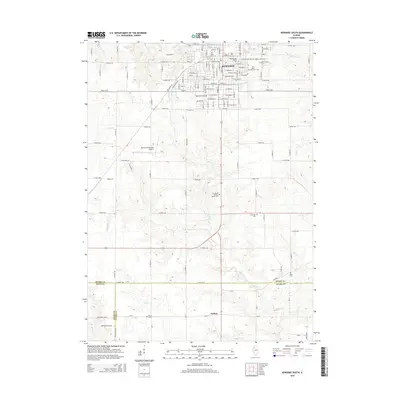
2015 Map of Kewanee South
USGS Topo · Published 2015About this map
Kewanee serves as the focal point of this Illinois survey, illustrating a dense grid of residential streets and civic landmarks including the Kewanee Municipal Airport. The town’s history is preserved through its numerous memorial grounds, ranging from the central Old Kewanee Public Cem and Mount Olivet Cem to the Wethersfield Cem on the southern edge of the core settlement. This concentration of burial sites, including the South Pleasant View Cem and the Pleasant View Cem, provides a significant resource for genealogical research in Henry County.
Find a feature on this map
69 named features on this map. Tap any name to fly to it.
Don’t see what you’re looking for? This feature index may not catch every label — zoom into the map to look around manually.
Map Details
Editions of this 2015 Kewanee South Map
This is the sole edition of this map. No revisions or reprints were ever made.
Other maps of this area

1929 · Annawan
USGS Topo · 1:62,500

1931 · Galva
USGS Topo · 1:48,000

1932 · Annawan
USGS Topo · 1:62,500

1934 · Geneseo
USGS Topo · 1:62,500

1940 · Galva
USGS Topo · 1:62,500

1944 · Galva
USGS Topo · 1:62,500

1944 · Kewanee
USGS Topo · 1:62,500

1953 · German Corner
USGS Topo · 1:24,000
1953 · Galva
USGS Topo · 1:24,000

1958 · Davenport
USGS Topo · 1:250,000