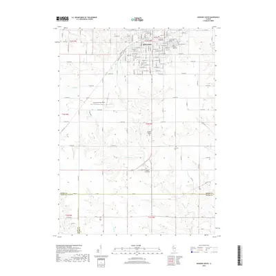
2018 Map of Kewanee South
USGS Topo · Published 2018About this map
Kewanee serves as the primary urban center for this prairie landscape, where the southern reaches of the city blend into the historical area of Wethersfield. The terrain is defined by a dense network of country roads and agricultural sections punctuated by numerous burial sites, reflecting generations of local history through names like Old Kewanee Public Cemetery, Wethersfield Cemetery, and Mount Olivet Cemetery.
Find a feature on this map
135 named features on this map. Tap any name to fly to it.
Don’t see what you’re looking for? This feature index may not catch every label — zoom into the map to look around manually.
Map Details
Editions of this 2018 Kewanee South Map
This is the sole edition of this map. No revisions or reprints were ever made.
Other maps of this area

1929 · Annawan
USGS Topo · 1:62,500

1931 · Galva
USGS Topo · 1:48,000

1932 · Annawan
USGS Topo · 1:62,500

1934 · Geneseo
USGS Topo · 1:62,500

1940 · Galva
USGS Topo · 1:62,500

1944 · Galva
USGS Topo · 1:62,500

1944 · Kewanee
USGS Topo · 1:62,500

1953 · German Corner
USGS Topo · 1:24,000
1953 · Galva
USGS Topo · 1:24,000

1958 · Davenport
USGS Topo · 1:250,000