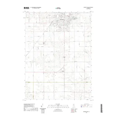
2021 Map of Kewanee South
USGS Topo · Published 2021About this map
The city of Kewanee serves as the focal point of this Henry County survey, where the street grid transitions into the expansive agricultural lands of northern Illinois. A high density of burial grounds, including the Old Kewanee Public Cem, Pleasant View Cem, and Mount Olivet Cem, provides a significant record of the community's ancestral history. The landscape is defined by the drainage systems of the Edwards River to the north and the various branches of Indian Cr to the south, which together shape the local topography. Higher education and regional infrastructure are represented by the Black Hawk College East Campus and the Kewanee Municipal Airport. This modern record of the area captures the intersection of three counties—Henry, Knox, and Stark—illustrating the persistent rural patterns and cemetery placements that have served these farming communities for generations.
Find a feature on this map
116 named features on this map. Tap any name to fly to it.
Don’t see what you’re looking for? This feature index may not catch every label — zoom into the map to look around manually.
Map Details
Editions of this 2021 Kewanee South Map
This is the sole edition of this map. No revisions or reprints were ever made.
Other maps of this area

1929 · Annawan
USGS Topo · 1:62,500

1931 · Galva
USGS Topo · 1:48,000

1932 · Annawan
USGS Topo · 1:62,500

1934 · Geneseo
USGS Topo · 1:62,500

1940 · Galva
USGS Topo · 1:62,500

1944 · Galva
USGS Topo · 1:62,500

1944 · Kewanee
USGS Topo · 1:62,500

1953 · German Corner
USGS Topo · 1:24,000
1953 · Galva
USGS Topo · 1:24,000

1958 · Davenport
USGS Topo · 1:250,000