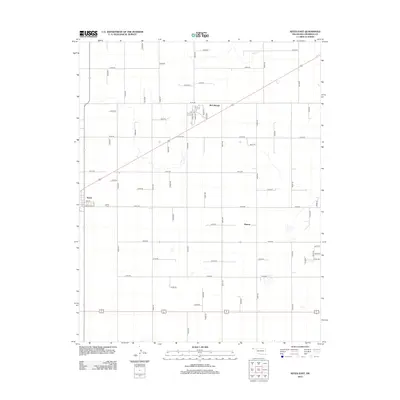
2012 Map of Keyes East
USGS Topo · Published 2012About this map
Keyes sits at the western edge of this 2012 survey in Cimarron County, where the high plains landscape is defined by a rigorous grid of section roads and the diagonal passage of the railroad. The terrain is marked by intermittent water features and ephemeral drainage basins, most notably Goff Cr in the northeast. Small outlying settlements like McCullough and Burton are situated along the transit corridors, reflecting the enduring agricultural and ranching patterns of the Oklahoma Panhandle. Within the township of Keyes, residential planning is visible through corridors such as Ramsey Blvd and 4th St, providing a clear record of the community's footprint as it stood in the early 21st century.
Find a feature on this map
52 named features on this map. Tap any name to fly to it.
Don’t see what you’re looking for? This feature index may not catch every label — zoom into the map to look around manually.
Map Details
Editions of this 2012 Keyes East Map
This is the sole edition of this map. No revisions or reprints were ever made.
Other maps of this area

1954 · Dalhart
USGS Topo · 1:250,000

1958 · Dalhart
USGS Topo · 1:250,000

1962 · Dalhart
USGS Topo · 1:250,000

1971 · Griggs NE
USGS Topo · 1:24,000

1971 · Sturgis
USGS Topo · 1:24,000

1971 · Keyes West
USGS Topo · 1:24,000

1971 · Hopkins
USGS Topo · 1:24,000

1971 · Keyes NE
USGS Topo · 1:24,000

1971 · Sampsel Lake
USGS Topo · 1:24,000

1971 · Keyes East
USGS Topo · 1:24,000