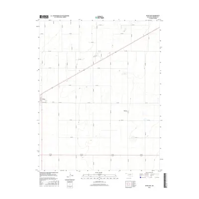
2016 Map of Keyes East
USGS Topo · Published 2016About this map
Keyes and the smaller settlement of Burton anchor this High Plains landscape in Cimarron County during the mid-2010s. The map reveals a highly structured section-line road grid, including Ramsey Blvd and Jackson Ave, which defines the agricultural layout of the region. This geometric precision is occasionally interrupted by the winding path of Goff Cr in the northeast and a scattering of small prairie depressions. The survey illustrates the intersection of modern transportation and traditional rural plotting, where US-56 and US-64/412 cut diagonally and horizontally across the cardinal-aligned local roads like N0430 Rd and E0140 Rd. It is a landscape of vast horizons where nearly every mile is accounted for by the systematic survey of the Oklahoma Panhandle.
Find a feature on this map
27 named features on this map. Tap any name to fly to it.
Don’t see what you’re looking for? This feature index may not catch every label — zoom into the map to look around manually.
Map Details
Editions of this 2016 Keyes East Map
This is the sole edition of this map. No revisions or reprints were ever made.
Other maps of this area

1954 · Dalhart
USGS Topo · 1:250,000

1958 · Dalhart
USGS Topo · 1:250,000

1962 · Dalhart
USGS Topo · 1:250,000

1971 · Griggs NE
USGS Topo · 1:24,000

1971 · Sturgis
USGS Topo · 1:24,000

1971 · Keyes West
USGS Topo · 1:24,000

1971 · Hopkins
USGS Topo · 1:24,000

1971 · Keyes NE
USGS Topo · 1:24,000

1971 · Sampsel Lake
USGS Topo · 1:24,000

1971 · Keyes East
USGS Topo · 1:24,000