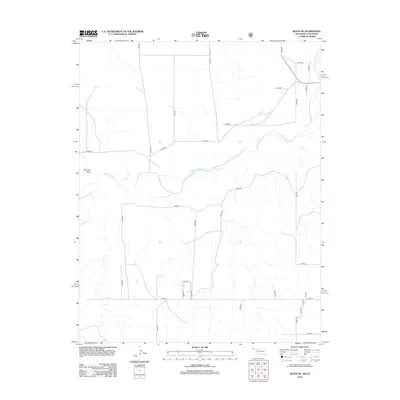
2012 Map of Keyes NE
USGS Topo · Published 2012About this map
The Cimarron River meanders across this high plains landscape at the border of Oklahoma and Colorado, defining the drainage patterns of Cimarron County. This area of the Panhandle is characterized by a precise grid of rural section roads, including Co Rd 41, Co Rd 43, and Co Rd 45, which support the region's agricultural and ranching operations. The topography is largely defined by the river's path and several intermittent drainage features like Burrows Draw, which cuts through the northwestern portion of the map.
Find a feature on this map
32 named features on this map. Tap any name to fly to it.
Don’t see what you’re looking for? This feature index may not catch every label — zoom into the map to look around manually.
Map Details
Editions of this 2012 Keyes NE Map
This is the sole edition of this map. No revisions or reprints were ever made.
Other maps of this area

1892 · Vilas
USGS Topo · 1:125,000

1954 · Dalhart
USGS Topo · 1:250,000

1955 · La Junta
USGS Topo · 1:250,000

1958 · La Junta
USGS Topo · 1:250,000

1958 · Dalhart
USGS Topo · 1:250,000

1962 · Dalhart
USGS Topo · 1:250,000

1968 · La Junta
USGS Topo · 1:250,000

1971 · Keyes SW
USGS Topo · 1:24,000

1971 · Keyes West
USGS Topo · 1:24,000

1971 · Keyes NW
USGS Topo · 1:24,000