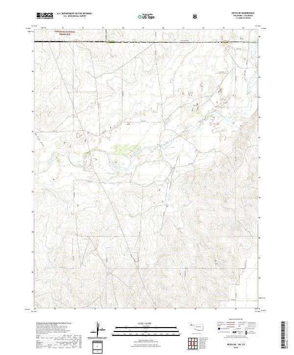
2022 Map of Keyes NE
USGS Topo · Published 2022About this map
The Cimarron River meanders across this high plains borderland, defining a landscape of wide drainage basins and rural section lines. Along the northern edge, a portion of the Comanche National Grassland sits just across the Colorado-Oklahoma state line in Baca County. The terrain is marked by significant topographical shifts where Burrows Draw and other seasonal drainage systems feed toward the river valley. This is a sparse, utilitarian landscape organized by a rigorous grid of section roads such as Co Rd 43 and E0030 Rd. The map reveals the intersection of the Oklahoma Panhandle's ranching country with the federally managed lands of the southern plains, illustrating how early surveying and subsequent land management have maintained a consistent settlement pattern into the modern era.
Find a feature on this map
36 named features on this map. Tap any name to fly to it.
Don’t see what you’re looking for? This feature index may not catch every label — zoom into the map to look around manually.
Map Details
Editions of this 2022 Keyes NE Map
This is the sole edition of this map. No revisions or reprints were ever made.
Other maps of this area

1892 · Vilas
USGS Topo · 1:125,000

1954 · Dalhart
USGS Topo · 1:250,000

1955 · La Junta
USGS Topo · 1:250,000

1958 · La Junta
USGS Topo · 1:250,000

1958 · Dalhart
USGS Topo · 1:250,000

1962 · Dalhart
USGS Topo · 1:250,000

1968 · La Junta
USGS Topo · 1:250,000

1971 · Keyes SW
USGS Topo · 1:24,000

1971 · Keyes West
USGS Topo · 1:24,000

1971 · Keyes NW
USGS Topo · 1:24,000