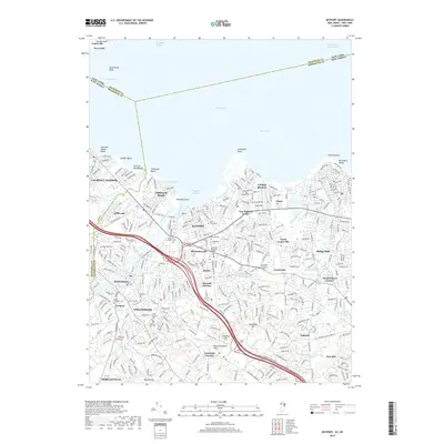
2019 Map of Keyport
USGS Topo · Published 2019About this map
Keyport Harbor and the southern reaches of Raritan Bay dominate this coastal landscape at the intersection of Middlesex and Monmouth counties. The transition from the dense street grids of Matawan and Union Beach to the higher elevations of Mount Pleasant Hills and Telegraph Hill illustrates the varied geography of the New York-New Jersey borderlands. Several older burial grounds, including Saint Josephs Cem and Cedarwood Cem, are situated near the established town centers, providing essential touchstones for genealogical research in this long-settled region.
Find a feature on this map
72 named features on this map. Tap any name to fly to it.
Don’t see what you’re looking for? This feature index may not catch every label — zoom into the map to look around manually.
Map Details
Editions of this 2019 Keyport Map
This is the sole edition of this map. No revisions or reprints were ever made.
Other maps of this area

1888 · Plainfield
USGS Topo · 1:62,500

1888 · New Brunswick
USGS Topo · 1:62,500

1888 · Sandy Hook
USGS Topo · 1:62,500

1893 · New Brunswick
USGS Topo · 1:62,500

1893 · Plainfield
USGS Topo · 1:62,500

1893 · Sandy Hook
USGS Topo · 1:62,500

1898 · Plainfield
USGS Topo · 1:62,500

1898 · Staten Island
USGS Topo · 1:62,500

1900 · Passaic
USGS Topo · 1:125,000

1900 · Staten Island
USGS Topo · 1:62,500