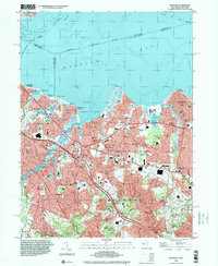
1995 Map of Keyport
USGS Topo · Published 2000About this map
Keyport Harbor and the southern reaches of Raritan Bay dominate the coastal topography of this Monmouth County shore area. The map illustrates a dense suburban landscape where old coastal villages like Keyport, Union Beach, and Keansburg are interconnected by the New York and Long Branch RR and the Garden State Parkway. The intersection of heavy infrastructure and natural watercourses is evident as Matawan Creek and Lupatcong Creek wind through developed neighborhoods.
Find a feature on this map
90 named features on this map. Tap any name to fly to it.
Don’t see what you’re looking for? This feature index may not catch every label — zoom into the map to look around manually.
Map Details
Editions of this 1995 Keyport Map
This is the sole edition of this map. No revisions or reprints were ever made.
Other maps of this area

1888 · Plainfield
USGS Topo · 1:62,500

1888 · New Brunswick
USGS Topo · 1:62,500

1888 · Sandy Hook
USGS Topo · 1:62,500

1893 · New Brunswick
USGS Topo · 1:62,500

1893 · Plainfield
USGS Topo · 1:62,500

1893 · Sandy Hook
USGS Topo · 1:62,500

1898 · Plainfield
USGS Topo · 1:62,500

1898 · Staten Island
USGS Topo · 1:62,500

1900 · Passaic
USGS Topo · 1:125,000

1900 · Staten Island
USGS Topo · 1:62,500