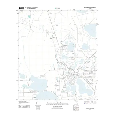
2012 Map of Keystone Heights
USGS Topo · Published 2012About this map
Keystone Heights is the focal point of this North Florida landscape, characterized by a dense concentration of lakes and recreational camps in the early 21st century. The map reveals a community deeply tied to its hydrology, with residential developments like Loch Lomond and Santa Fe Beach situated along the shores of Lake Brooklyn, Lake Geneva, and Santa Fe Lake. The northern reach of the Santa Fe River winds through the west, while numerous smaller bodies of water like Mosquito Lake and Crystal Lake punctuate the piney woods.
Find a feature on this map
187 named features on this map. Tap any name to fly to it.
Don’t see what you’re looking for? This feature index may not catch every label — zoom into the map to look around manually.
Map Details
Editions of this 2012 Keystone Heights Map
This is the sole edition of this map. No revisions or reprints were ever made.
Other maps of this area

1915 · Interlachen
USGS Topo · 1:48,000

1916 · Interlachen
USGS Topo · 1:62,500

1938 · Hawthorn
USGS Topo · 1:48,000

1941 · Starke
USGS Topo · 1:62,500

1942 · Ates Creek
USGS Topo · 1:62,500

1943 · Hawthorn
USGS Topo · 1:62,500

1944 · Interlachen
USGS Topo · 1:62,500

1948 · Starke
USGS Topo · 1:50,000

1949 · Sampson
USGS Topo · 1:24,000

1949 · Gold Head Branch
USGS Topo · 1:24,000