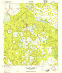
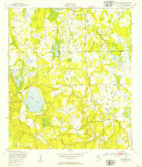
1949 Map of Gold Head Branch
USGS Topo · Published 1953About this map
Gold Head Branch State Park centers this landscape in the late 1940s, a region defined by a dense cluster of solution-depression lakes and sinkholes. The terrain is marked by significant hydrological features including Sand Hill Lake, Lake Johnson, and the namesake Gold Head Branch. The presence of the Southern railroad line and the Mobile Target Range suggests a mix of transport utility and military land use common in this part of Florida during the mid-century period.
Find a feature on this map
20 named features on this map. Tap any name to fly to it.
Don’t see what you’re looking for? This feature index may not catch every label — zoom into the map to look around manually.
Map Details
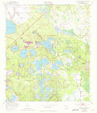
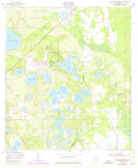
Editions of this 1949 Gold Head Branch Map
3 editions found
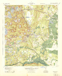
Other maps of this area

1915 · Interlachen
USGS Topo · 1:48,000

1916 · Interlachen
USGS Topo · 1:62,500

1938 · Hawthorn
USGS Topo · 1:48,000

1941 · Starke
USGS Topo · 1:62,500

1942 · Ates Creek
USGS Topo · 1:62,500

1943 · Hawthorn
USGS Topo · 1:62,500
1944 · Interlachen
USGS Topo · 1:62,500

1948 · Starke
USGS Topo · 1:50,000
1949 · Rice Creek
USGS Topo · 1:24,000
1949 · Baywood
USGS Topo · 1:24,000