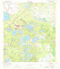
1949 Map of Gold Head Branch
USGS Topo · Published 1972About this map
Gold Head Branch State Park anchors the terrain of this north-central Florida landscape, where a complex network of sinkhole lakes and wetlands defines the geography. The map reveals a transition in land use between the late 1940s and the 1970 photorevision, highlighting the distinctive hydrological features of the region including Sand Hill Lake, Johnson Lake, and the expansive Smith Lake. A long Canal and several smaller waterways like Devils Den Creek illustrate early drainage efforts across the Clay and Putnam County line.
Find a feature on this map
20 named features on this map. Tap any name to fly to it.
Don’t see what you’re looking for? This feature index may not catch every label — zoom into the map to look around manually.
Map Details
Editions of this 1949 Gold Head Branch Map
3 editions found

Other maps of this area

1915 · Interlachen
USGS Topo · 1:48,000

1916 · Interlachen
USGS Topo · 1:62,500

1938 · Hawthorn
USGS Topo · 1:48,000

1941 · Starke
USGS Topo · 1:62,500

1942 · Ates Creek
USGS Topo · 1:62,500

1943 · Hawthorn
USGS Topo · 1:62,500

1944 · Interlachen
USGS Topo · 1:62,500

1948 · Starke
USGS Topo · 1:50,000

1949 · Rice Creek
USGS Topo · 1:24,000

1949 · Baywood
USGS Topo · 1:24,000